skip to navigation
|
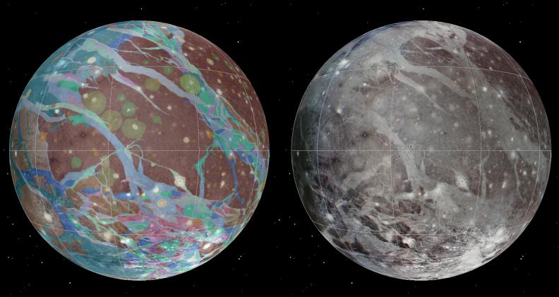
Ganymede Global Geologic Map and Global Image Mosaic
- Click the image above for a larger view
- Full-Res JPEG (1800 x 956) (213.7 kB)
- Full-Res TIFF (1800 x 956) (5.2 MB)
Caption:
To present the best information in a single view of Jupiter's moon Ganymede, a global image mosaic was assembled, incorporating the best available imagery from NASA's Voyager 1 and 2 spacecraft and NASA's Galileo spacecraft. This image shows Ganymede centered at 200 west longitude. This mosaic (right) served as the base map for the geologic map of Ganymede (left).
Cataloging Keywords:
| Name | Value | Additional Values |
|---|---|---|
| Target | Ganymede | |
| System | Jupiter | |
| Target Type | Satellite | |
| Mission | Galileo | Voyager |
| Instrument Host | Galileo Orbiter | Voyager 1, Voyager 2 |
| Host Type | Orbiter | Flyby Spacecraft |
| Instrument | ||
| Detector | ||
| Extra Keywords | Color, Map | |
| Acquisition Date | ||
| Release Date | 2014-02-12 | |
| Date in Caption | ||
| Image Credit | USGS Astrogeology Science Center/Wheaton/NASA/JPL-Caltech | |
| Source | photojournal.jpl.nasa.gov/catalog/PIA17901 | |
| Identifier | PIA17901 | |